Encyclopédie Marikavel-Jean-Claude-EVEN/Encyclopaedia/Enciclopedia/Enzyklopädie/egkuklopaideia
|
|
||
England Bro-Saoz |
Water-Eaton Pennocrucium |
Staffordshire *** |
| page ouverte le 28.07.2005 | * forum du site Marikavel : Academia Celtica | dernière mise à jour 02/06/2012 17:36:26 |
![]()
|
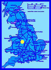
Définition : Angleterre; comté de Staffordshire. |
|
![]()
|
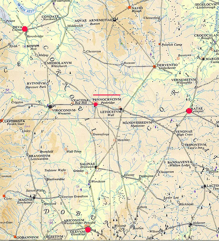
Extrait de la carte Map of Roman Britain, par Ordnance Survey |
![]()
|
Histoire : |
![]()
|
Étymologie : * A.LF. Rivet & Colin Smith , p 436-437 : SOURCE. - AI 4701 (Iter II) : PENNOCRUCIO. DERIVATION. The first element is British *penno- 'head, hill; end; (as adj.) chief, represented now by Welsh penn, Cornish and Breton pen, and presumably related to *pen- of wide Mediterranean (Ligurian?) currency, in names ail meaning 'hill, height'. In Q-Celtic *quenno-s gave Irish cend, cen, ceann. Older *penno- or Welsh and Cornish pen (n)- is abundantly represented in the toponymy of modem Wales, Cornwall and adjoining areas. Zachrisson (1927) 49 collected many of them; he has interesting early forms for Pentridge (Dorset), evidently identical in origin to the present name. Ancient place-names include Pennelocos of Al 35i7 ( = Pennolucos of TP) ' head of the lake ' (Lake Geneva) now Villeneuve (Switzerland), and a *Pennovindos (= Welsh Penwyn) 'white hill '> Pavant (Aisne, France), noted by Dottin LG 75. The second element is British *crôco-, older *crouco-, for which see CROCOCALANA; with *-io- suffix. AI's form with -u- (-crucio) might show that the name was adopted from British not earlier than the late third century, or that the recorded Latin form reflects the late third-century evolution of the British vowel (ou > ô > u) ; but it is more likely that AI's form is not altogether trustworthy, and that the u represents o, as often. The sense presents a problem. 'Chief mound' or perhaps 'tumulus on the hill' seems obvious, but M. Gelling (1978, p. 41) finds this 'inexplicable in terms of the modem topography', since the crossroads at which the Romano-British settlement stands is not on a hill, and there is no trace of a tumulus. G. Webster in Wacher (1966), 44, thought that the name 'may originally have derived from a native hill-fort on the higher ground to the south-west' (for a similar transference, compare perhaps BANNAVENTA1), and in The Cornovii (1975, p. 78) speculates that alternatively the name 'could signify a spécial assembly point for the tribe, or a place of some local importance'. Gelling suggests 'that there might have been a great tumulus called "the chief mound" on the site of the town, of which no trace remains, or that the name was that of a large district and the mound lay elsewhere'. These views seem to cover all the diverse possibilities. IDENTIFICATION. The Roman seulement (succeeding forts) at Water Eaton, Staffordshire (SJ 9010), on the river Penk and 2-1/2 miles south of modem Penkridge. The nearest known hill-fort to the south-west is Chesterton Walls, 10 miles distant; Castle Ring (9 miles to thé east) is nearer to Letocetum than to Pennocrucium and even the nearest hill-fort, Berry Ring (6,1/2 miles to the north), is too remote. No tumulus is known near here. Note. The name survives in that of the village of Penkridge, via Anglo-Saxon Pencric (A.D 958); this was taken from speakers of Brittonic with the second c intact as a velar (LHEB 260). The name of the river Penk derives by back-formation (with wrongly perceived division) from that of the village. ***** * JC Even, Carohaise, 1999 : Pennocrucium : Forteresse romaine de Grande-Bretagne, sur la route de Londres à Chester, non loin de la source de la rivière Penk (qui en tire son nom). L'étymologie sur penn-cruc-, pour signifier le sommet de la butte, ou le sommet du tumulus, laisse les chercheurs perplexes et dubitatifs, contrairement à Ekwall, car il n'y a aucune trace de tumulus ni sur le site, ni à proximité, et l'endroit lui même correspond très exactement à un pays bas, au démarrage des montées des petites collines voisines, mais non sur celles-ci. Il est caractérisé également par son environnement humide, comme en témoignent les toponymes liés à water, brook, à plusieurs retenues d'eau, etc. Plusieurs sites voisins de Pennocrucium comportent le suffixe anglais -ford qui désigne des gués : Crateford, Somerford, Standeford (le gué empierré), Ford Houses, Pendeford (Pende- : le nom de la rivière ? voir le nom de la rivière bretonne Penzé ! où un nom de personne Penda ? (E. Ekwall), Bickford (Bica's ford : nom de personne), Stafford (Stæþ-ford, gué près d'un stæþ- = aire clôturée), Milford (gué du moulin), etc. Dans la mesure ou le camp est situé non loin de la source de la rivière, on peut avancer la racine Penn : tête, à l'instar des sources des rivières de Petite-Bretagne (Pen-Jaudy, Pen- Léguer, etc). Quant à -cruc-, on pourrait, compte tenu de la position près de l'extrémité d'une vallée, faire une recherche à partir de crique (angl. creek = petite baie, courbe de rivière, fente, crevasse, recoin), bien que les formes proposées présentent un son en i et non en ü ou en ou. (voir Onions, Oxford Dictionary ..., p 227), ou rechercher un thème *Kr°k > *Gr°g, représentant une forme archaïque de la racine étudiée à propos du breton glas = bleu et du Vieil-anglais græg = gris. On pourra alors rapprocher ce nom de la traduction erronée donnée pour la station voisine de Letocetum (Bois Gris, Forêt bleue), qui est la continuation de la forêt sur le plateau dominant la vallée de Pennocrucium et pour lequel, dans ce cas, les noms se confirment réciproquement. A l'emplacement de l'ancien camp romain de Pennocrucium se trouve aujourd'hui le village de Stretton ( Stræt-tùn = village près de la route romaine), près du gué. ***** |
![]()
|
Liens électroniques des sites Internet traitant de Water-Eaton / Penkridge / Pennocrucium : * lien communal : * forum du site Marikavel : Academia Celtica
hast buan, ma mignonig go fast, my little friend |
![]()